Codice 010-02602-0
Access multiple global navigation satellite systems (GPS, GLONASS, Galileo, and QZSS). You can access multiple frequencies sent by satellite systems for more accurate positioning in areas where GNSS signals are reflected, weak, or generally cannot penetrate.
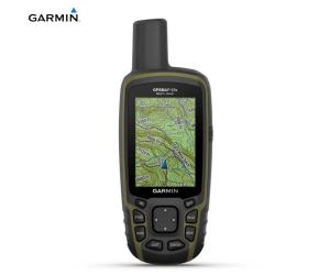
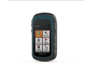
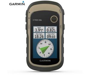
Navigate every trail with ABC sensors, which include an altimeter for elevation data, a barometer to monitor weather and a 3-axis electronic compass.
Download high-resolution, photorealistic maps directly to your device using Wi-Fi
® technology. Easily find routes, choose locations, find parking, create waypoints and much more.
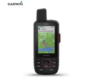
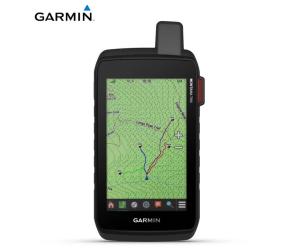
Maps Preloaded TopoActive maps for Europe show mountain peaks, parks, coastlines, rivers, lakes and geographic points.
Activate shipping mode and operate with a battery life of up to 425 hours when using inReach technology. In the default tracking mode, the battery provides up to 165 hours and the device detects your location every 10 minutes.
With an Outdoor Maps+ subscription, you can get public land information, landowner names, state maps, game management unit boundaries, BLM boundaries, and more.
Text messages with friends/family, post on social media, or communicate from one inReach device to another.
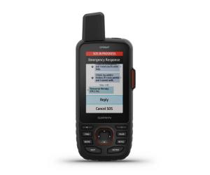
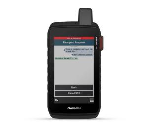
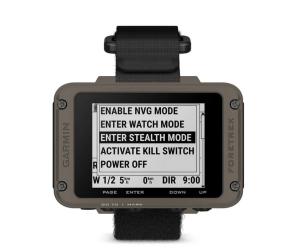
In case of emergency, activate an interactive SOS message to Garmin Response
SM , the 24/7 global emergency response coordination center.
Track your location and share it with friends and family. They can see your movements or locate your device to find your GPS location and more.
Instead of relying solely on smartphone coverage, your messages, SOS requests and tracking are now transmitted via the Iridium global satellite network.
Download
the Garmin Messenger app to your compatible smartphone and pair it with your
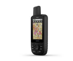
GPSMAP® 67i handheld, for quick, easy messaging and 24/7 SOS even when you’re outside of cellular coverage areas
1 . The app also supports group messaging.
Plan, review and sync waypoints, routes and tracks using the
Garmin Explore app and website. You can even review completed activities while you're still out there.
Use inReach connectivity to get detailed weather updates on your GPSMAP 67i handheld. Get weather forecasts for your current location, waypoints or destinations along the way.
Once connected to the Garmin Explore smartphone app, you can access real-time forecast information, so you can stay up-to-date on weather trends.
Specifications: Lens Material: Chemically Strengthened Glass
Dimensions: 6.1 x 16.3 x 3.5 cm
Weight: 230g with batteries
MIL-STD-810: Yes thermal, shock, water; bare unit only
Waterproof rating: IPX7
Screen type: 3″ TFT transflective, color
Display Size, WxH: 3.8 cm x 6.3 cm; 3″ diag (7.6cm)
Screen resolution, WxH: 240 x 400 pixels
Battery: Lithium-ion, rechargeable
Battery life: Up to 165 hours with In Reach enabled and 10-minute tracking, up to 180 hours in GPS mode, up to 840 hours in expedition mode
Memory/History: 16 GB (User space varies based on included maps)
Interface: USB C
Preloaded maps: Yes (TopoActive Europe; routable roads)
Additional cartography: Yes
World Basemap: Yes
Automatic route calculation (with precise turn-by-turn directions): Yes
Map segments: 15000
Birdseye: Yes directly on the device
Includes detailed hydrographic information (coastlines, river/lake banks, wetlands and perennial and seasonal watercourses): Yes
Includes searchable points of interest (parks, campgrounds, scenic spots, and picnic areas): Yes
Allows you to view national, state and local parks, forests and nature reserves: Yes
Storage and Power Capacity: 32GB max microSD™ (not included)
Memorable positions: 10000
Tracks: 250
Track log: 20,000 points, 200 saved gpx tracks, 300 saved fitness activities
Activity: Yes
Memorable routes: 250, 250 points per route; automatic route calculation 50 points
Sensors:- GPS
- GLONASS
- GALILEO
- QZSS
- BEIDOU
- IRNSS
- Barometric altimeter
- 3-axis tilt-compensated compass
- High sensitivity GPS receiver
- GPS Compass (On the move)
- Multi-band frequency